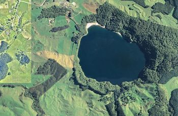
Aerial Photography

|
| Aerial Photograph |
"Aerial photograph interpretation of earth materials and geologic features is relatively simple and straightforward, but experience is required. Diagnostic features include terrain position, topography, drainage and erosional features, color tones, and vegetation cover. Interpretation is limited mainly to surface and near-surface conditions. Special cases arise, however, where features on a photograph permit reliable predictions to be made of deep, underground conditions. Although interpretation can be rendered from any sharp photograph, resolution is a limiting factor because small-scale photographs limit the amount of detailed information that can be obtained. The scale of 1:20,000 is satisfactory for some engineering and geologic interpretation of surface materials. Small-scale photographs are used for highly detailed work such as for reservoir clearing estimates and for geologic mapping of damsites and reservoir areas."[1]
"Aerial photographs can be used to identify many terrain types and landforms. Stereoscopic photograph inspection of regional topography, local terrain features, and drainage conditions usually will suffice to identify the common terrain type. This permits the possible range in soil and rock materials to be anticipated and their characteristics to be defined within broad limits."[1]
"Geologic features that may be highly significant to the location or performance of engineering structures can often be identified from aerial photographs. In many instances, these features can be more readily identified on an aerial photograph than on the ground. However, aerial photograph interpretation is applicable only to those feature that develop recognizable geomorphic features such as surface expressions such as drainage patterns, old river channels, and alignment of ridges or valley. Joint systems, landslides, fault zones, lineations, folds, and other structural features are sometimes identified quickly in an aerial photograph, whereas it may be difficult to find them on the ground. The general attitude, bedding, and jointing of exposed rock strata, as well as the presence of dikes and intrusions, can often be seen in aerial photographs. The possibilities of landslides into open cuts and of seepage losses from reservoirs can be assessed."[1]
Best Practices Resources
![]() Earth Manual Part 1 (USBR, 1998)
Earth Manual Part 1 (USBR, 1998)
![]() National Engineering Handbook: Chapter 2 - Engineering Geologic Investigations (NRCS, 2012)
National Engineering Handbook: Chapter 2 - Engineering Geologic Investigations (NRCS, 2012)
![]() Engineering Geology Field Manual 2nd Edition, Volume 2 (USBR, 2001)
Engineering Geology Field Manual 2nd Edition, Volume 2 (USBR, 2001)
![]() Design of Small Dams (USBR, 1987)
Design of Small Dams (USBR, 1987)
Trainings
![]() On-Demand Webinar: Use of Remote Sensing in Dam Safety-Including Drones
On-Demand Webinar: Use of Remote Sensing in Dam Safety-Including Drones
![]() On-Demand Webinar: Use of Underwater Remote Systems in Dam Safety
On-Demand Webinar: Use of Underwater Remote Systems in Dam Safety
Citations:
Revision ID: 4080
Revision Date: 11/02/2022
