
Survey: Difference between revisions
Rmanwaring (talk | contribs) No edit summary |
Rmanwaring (talk | contribs) No edit summary |
||
| Line 14: | Line 14: | ||
“Surveys shall be performed at night to avoid troublesome optical distortions due to sunlight and heat radiation. The surveys shall be in accordance with the accuracy with methods established for first-order triangulation measurements as stipulated by the U.S. Coast and Geodetic Survey.”<ref name="EM 1110-2-4300">[[Instrumentation for Concrete Structures (EM 1110-2-4300) | EM 1110-2-4300 Instrumentation for Concrete Structures (USACE, 1987)]]</ref> | “Surveys shall be performed at night to avoid troublesome optical distortions due to sunlight and heat radiation. The surveys shall be in accordance with the accuracy with methods established for first-order triangulation measurements as stipulated by the U.S. Coast and Geodetic Survey.”<ref name="EM 1110-2-4300">[[Instrumentation for Concrete Structures (EM 1110-2-4300) | EM 1110-2-4300 Instrumentation for Concrete Structures (USACE, 1987)]]</ref> | ||
==[[Best Practices Resources]]== | ==[[Best Practices Resources]]== | ||
Revision as of 22:28, 7 November 2022
|
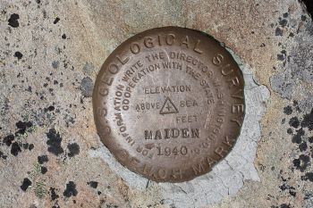
| USGS Survey Marker |
Survey data is vital to the monitoring of a dam and helps to warn dam owners of potential problems occurring in or around the dam over time. Without comparisons between past and current survey, imperceptible changes in the positioning of the dam over time are likely to go unnoticed.
“Surveys shall be performed at night to avoid troublesome optical distortions due to sunlight and heat radiation. The surveys shall be in accordance with the accuracy with methods established for first-order triangulation measurements as stipulated by the U.S. Coast and Geodetic Survey.”[1]
Best Practices Resources
![]() Structural Deformation Surveying (EM 1110-2-1009) (USACE, 2018)
Structural Deformation Surveying (EM 1110-2-1009) (USACE, 2018)
![]() Survey Markers and Instrumentation (EM 1110-1-1002) (USACE, 2012)
Survey Markers and Instrumentation (EM 1110-1-1002) (USACE, 2012)
Trainings
![]() On-Demand Webinar: Using Instrumentation for Dam Safety Monitoring
On-Demand Webinar: Using Instrumentation for Dam Safety Monitoring
Citations:
Revision ID: 4143
Revision Date: 11/07/2022