
Survey: Difference between revisions
Rmanwaring (talk | contribs) (Created page with "<!-- Delete any sections that are not necessary to your topic. Add pictures/sections as needed --> __NOTOC__ ---- {{Picture <!-- Add image file name (ex.image.jpg) --> |image= United_States_National_Geodetic_Survey_marker_5667.JPG <!--Add link if applicable --> |link= <!-- Add picture caption --> |caption= USGS Survey Marker }} Survey data is vital to the monitoring of a dam and helps to warn dam owners of potential problems occurring in or around the dam over...") |
No edit summary |
||
| (12 intermediate revisions by 3 users not shown) | |||
| Line 1: | Line 1: | ||
<!-- Delete any sections that are not necessary to your topic. Add pictures/sections as needed --> | <!-- Delete any sections that are not necessary to your topic. Add pictures/sections as needed --> | ||
__NOTOC__ | __NOTOC__ | ||
[[Category:Movement Surveillance and Monitoring]] | |||
---- | ---- | ||
{{Picture | {{Picture | ||
| Line 8: | Line 9: | ||
|link= | |link= | ||
<!-- Add picture caption --> | <!-- Add picture caption --> | ||
|caption= USGS Survey Marker | |caption= USGS Survey Marker. | ||
(Image Source: [https://commons.wikimedia.org/wiki/File:United_States_National_Geodetic_Survey_marker_5667.JPG Wikimedia]) | |||
}} | }} | ||
Survey data is vital to the monitoring of a dam and helps to warn dam owners of potential problems occurring in or around the dam over time. Without comparisons between past and current survey, imperceptible changes in the positioning of the dam over time are likely to go unnoticed. | Survey data is vital to the monitoring of a dam and helps to warn dam owners of potential problems occurring in or around the dam over time. Without comparisons between past and current survey, imperceptible changes in the positioning of the dam over time are likely to go unnoticed. | ||
"Dams, locks, levees, embankments, and other flood control structures are subject to external loads that cause deformation and permeation of the structure itself, as well as its foundations. Any indication of abnormal behavior may threaten the safety of the structure. Careful monitoring of the loads on a structure and its response to them can aid in determining abnormal behavior of that structure. In general, monitoring consists of both measurements and visual [[inspections]]... To facilitate the monitoring of the structures, they should be permanently equipped with proper instrumentation and/or monitoring points per the goals of the observation, structure type and size, and site conditions"<ref name="EM 1110-2-1009">[[Structural Deformation Surveying (EM 1110-2-1009) | Structural Deformation Surveying (EM 1110-2-1009), USACE, 2018]]</ref> | |||
= | “Surveys shall be performed at night to avoid troublesome optical distortions due to sunlight and heat radiation. The surveys shall be in accordance with the accuracy with methods established for first-order triangulation measurements as stipulated by the U.S. Coast and Geodetic Survey.”<ref name="EM 1110-2-4300">[[Instrumentation for Concrete Structures (EM 1110-2-4300) | EM 1110-2-4300 Instrumentation for Concrete Structures, USACE, 1987]]</ref> | ||
==Relevant Survey Topics== | |||
*[[Accuracy Requirements for Surveys]] | |||
*[[Monuments]] | |||
==Best Practices Resources== | |||
{{Document Icon}} [[Structural Deformation Surveying (EM 1110-2-1009) | Structural Deformation Surveying (EM 1110-2-1009), USACE]] | |||
{{Document Icon}} [[Survey Markers and Instrumentation (EM 1110-1-1002) | Survey Markers and Instrumentation (EM 1110-1-1002), USACE]] | |||
{{Document Icon}} [[Instrumentation for Concrete Structures (EM 1110-2-4300) | Instrumentation for Concrete Structures (EM 1110-2-4300), USACE]] | |||
{{Document Icon}} [[Survey Markers and | |||
{{Document Icon}} [[Instrumentation for Concrete Structures (EM 1110-2-4300) | EM 1110-2-4300 | |||
==Trainings== | ==Trainings== | ||
Latest revision as of 16:08, 18 July 2023
|
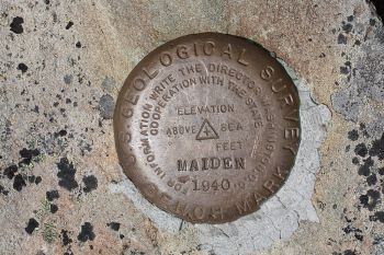
| USGS Survey Marker.
(Image Source: Wikimedia) |
Survey data is vital to the monitoring of a dam and helps to warn dam owners of potential problems occurring in or around the dam over time. Without comparisons between past and current survey, imperceptible changes in the positioning of the dam over time are likely to go unnoticed.
"Dams, locks, levees, embankments, and other flood control structures are subject to external loads that cause deformation and permeation of the structure itself, as well as its foundations. Any indication of abnormal behavior may threaten the safety of the structure. Careful monitoring of the loads on a structure and its response to them can aid in determining abnormal behavior of that structure. In general, monitoring consists of both measurements and visual inspections... To facilitate the monitoring of the structures, they should be permanently equipped with proper instrumentation and/or monitoring points per the goals of the observation, structure type and size, and site conditions"[1]
“Surveys shall be performed at night to avoid troublesome optical distortions due to sunlight and heat radiation. The surveys shall be in accordance with the accuracy with methods established for first-order triangulation measurements as stipulated by the U.S. Coast and Geodetic Survey.”[2]
Relevant Survey Topics
Best Practices Resources
![]() Structural Deformation Surveying (EM 1110-2-1009), USACE
Structural Deformation Surveying (EM 1110-2-1009), USACE
![]() Survey Markers and Instrumentation (EM 1110-1-1002), USACE
Survey Markers and Instrumentation (EM 1110-1-1002), USACE
![]() Instrumentation for Concrete Structures (EM 1110-2-4300), USACE
Instrumentation for Concrete Structures (EM 1110-2-4300), USACE
Trainings
![]() On-Demand Webinar: Using Instrumentation for Dam Safety Monitoring
On-Demand Webinar: Using Instrumentation for Dam Safety Monitoring
Citations:
Revision ID: 7288
Revision Date: 07/18/2023