
Floodplain: Difference between revisions
From ASDSO Dam Safety Toolbox
Rmanwaring (talk | contribs) (Created page with "<!-- Delete any sections that are not necessary to your topic. Add pictures/sections as needed --> __NOTOC__ <!-- Add Category to drive breadcrumb menus --> Category: Environmental ---- {{Picture <!-- Add image file name (ex.image.jpg) --> |image= <!--Add link if applicable --> |link= <!-- Add picture caption --> |caption= }} <!-- Introductory paragraph or topic page summary --> "Channel capacity also depends on the long-term trends in downstream flo...") |
Rmanwaring (talk | contribs) No edit summary |
||
| Line 6: | Line 6: | ||
{{Picture | {{Picture | ||
<!-- Add image file name (ex.image.jpg) --> | <!-- Add image file name (ex.image.jpg) --> | ||
|image= | |image= Canning_River_fork.jpg | ||
<!--Add link if applicable --> | <!--Add link if applicable --> | ||
|link= | |link= | ||
<!-- Add picture caption --> | <!-- Add picture caption --> | ||
|caption= | |caption= Canning River fork with floodplain. | ||
}} | }} | ||
Revision as of 23:00, 12 December 2022
|
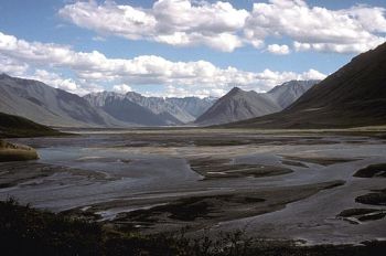
| Canning River fork with floodplain. |
"Channel capacity also depends on the long-term trends in downstream floodplain land use. While it is not a hydrologic problem, channel capacity studies should recognize the impact of floodplain encroachments on what is considered the nondamaging channel capacity. Anecdotal history has shown that many Corps' projects are not able to make planned channel-capacity releases due to development and encroachment downstream."[1]
Best Practices Resources
![]() Hydrologic Engineering Requirements for Reservoirs (EM 1110-2-1420), USACE, 1997
Hydrologic Engineering Requirements for Reservoirs (EM 1110-2-1420), USACE, 1997
Citations:
Revision ID: 5199
Revision Date: 12/12/2022